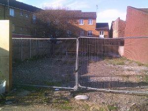
Contaminated Land Identified as Environmental Factor Most Likely to Cause Upset to a Housing Development
A recent survey by Development+Infrastructure identified contaminated land as the environmental factor most likely to cause upset to a housing development, followed by flood risk, more details here.
Once again it shows that the importance of taking advice at the earliest stage cannot be over stated. As my grandmother used to say, forewarned is forearmed.
Builders Shun Brownfield Sites to Dig up Green Belt – The Times 12 December 2017
An article in The Times declares that research by the Campaign to Protect Rural England (CPRE) shows that sites with the capacity for nearly 200,000 homes are missing from the official Brownfield Registers. With limited resources local authorities tend to concentrate on the larger sites, meaning that this vital resource of smaller sites is overlooked.
We have extensive experience of providing advice on small sites and are on the steering group for the CIRIA small brownfield sites report, which is due to be published shortly with advice on developing small brownfield sites.
We provide comprehensive support to guide clients through the process of obtaining discharge of contaminated land planning conditions, if you are considering buying or developing a small brownfield site do not hesitate to call 020 8291 1354 or askgo@gosolve.co.uk.
Image
The London Plan; The Spatial Development Strategy for Greater London
The Mayor has published a draft for public consultation, about which he says “So this London Plan sets out a new way of doing things, something I am calling Good Growth.” If you have any comments the consultation period runs to 2 March 2018.
The report has quite a lot to say about housing and the use of brownfield sites.
Efficient Land Use
In a section titled “Making the best use of land” the report points out that “London’s population is set to grow from 8.9 million today to around 10.8 million by 2041… This rapid growth will bring many opportunities, but it will also lead to increasing and competing pressures on the use of space. To accommodate growth while protecting the Green Belt, and for this growth to happen in a way that improves the lives of existing and new Londoners, this Plan proposes more efficient uses of the city’s land.”
The report then develops the theme of more efficient land use:
“1.2.2 The key to achieving this will be taking a rounded approach to the way neighbourhoods operate… This will mean creating places of higher density in appropriate locations to get more out of limited land, encouraging a mix of land uses, and co-locating different uses to provide communities with a wider range of services and amenities.
1.2.3 The benefits of this approach are wide-ranging… High-density, mixed use places support the clustering effect of businesses known as ‘agglomeration’, maximising job opportunities… They are places where local amenities are within walking and cycling distance, and public transport options are available for longer trips, supporting good health, allowing strong communities to develop, and boosting the success of local businesses.
1.2.4 Making the best use of land means directing growth towards the most accessible and well-connected places, making the most efficient use of the existing and future public transport, walking and cycling networks…
1.2.5 All options for using the city’s land more effectively will need to be explored as London’s growth continues, including the redevelopment of brownfield sites and the intensification of existing places, including in outer London. New and enhanced transport links will play an important role in allowing this to happen, unlocking homes and jobs growth in new areas and ensuring that new developments are not planned around car use…
Policy GG2 Making the best use of land
To create high-density, mixed-use places that make the best use of land, those involved in planning and development must:
A Prioritise the development of Opportunity Areas, brownfield land, surplus public sector land, sites which are well-connected by existing or planned Tube and rail stations, sites within and on the edge of town centres, and small sites.
B Proactively explore the potential to intensify the use of land, including public land, to support additional homes and workspaces, promoting higher density development, particularly on sites that are well-connected by public transport, walking and cycling, applying a design–led approach.
C Understand what is valued about existing places and use this as a catalyst for growth and place-making, strengthening London’s distinct and varied character.
D Protect London’s open spaces, including the Green Belt, Metropolitan Open Land, designated nature conservation sites and local spaces, and promote the creation of new green infrastructure and urban greening.
E Plan for good local walking, cycling and public transport connections to support a strategic target of 80 per cent of all journeys using sustainable travel, enabling car-free lifestyles that allow an efficient use of land, as well as using new and enhanced public transport links to unlock growth.
F Maximise opportunities to use infrastructure assets for more than one purpose, to make the best use of land and support efficient maintenance…
Delivering the housing London needs
1.4.5 To meet the growing need, London must seek to deliver new homes through every available means. Reusing large brownfield sites will remain crucial, although vacant plots are now scarce, and the scale and complexity of large former industrial sites makes delivery slow. Small sites in a range of locations can be developed more quickly, and enable smaller builders to enter the market. Building more housing as part of the development of town centres will also be important, providing homes in well-connected places that will help to sustain local communities…
Increasing housing supply
Policy H1 urges that: boroughs should optimise the potential for housing delivery on all suitable and available brownfield sites through their Development Plans and planning decisions… Boroughs should proactively use brownfield registers and permission in principle to increase planning certainty for those wishing to build new homes…
Small Sites
Under Policy H2 Small sites the report says that: Boroughs should increase planning certainty on small sites by:
1) identifying and allocating appropriate small sites for residential development
2) listing these sites on their brownfield registers
3) granting permission in principle on specific sites or preparing local development orders…
Vacant building Credit
In section 4.9.1 there is a reminder that: “In 2014 the Government introduced a Vacant Building Credit (VBC), which applies to sites where a vacant building is brought back into any lawful use, or is demolished to be replaced by a new building. The VBC reduces the requirement for affordable housing contributions based on the amount of vacant floor space being brought back into use or redeveloped. This has significant implications for delivery of affordable housing in London where a high proportion of development is on brownfield land where there are existing buildings.”
CIRIA launch Contaminated Land Guidance Tool
We are proud sponsors of this resource, which is designed to be the place the industry goes to find directions to the current documents and guidance.
The CIRIA website states: “Over the last two decades CIRIA, as well as publishing over 50 guides on contaminated land, has gathered information on more than 200 industry guidance documents that help practitioners and other stakeholders to assess and manage risk related to contaminated land and brownfield sites in the UK. Following suggestions from members, information on these references has been compiled in a searchable form. ”
Image

Network Rail hits buffers over Japanese Knotweed
A recent case involving Network Rail highlights the potentially costly effects of ignoring Japanese Knotweed and allowing it to grow unchecked.
Two neighbours took action after the plant, growing on a railway embankment next to their homes, spread into their properties, resulting the the values being almost halved. In this case the neighbours argued that the knotweed encroached on their homes which caused a nuisance and interfered with the quiet enjoyment of their property. In judgement at the crown Network Rail were ordered to pay £4,320 to each claimant to treat the knotweed and in what is being seen as a key test case, awarded £10,000 each in compensation for the fall in value of their homes.
This has clear implications not only for Network Rail, who of course have innumerable neighbours, but also for all landowners, who should now be redoubling their efforts to identify and control any Japanese Knotweed on their land.
Permission in Principle
New powers enabling local planning authorities (LPAs) in England to grant planning ‘permission in principle‘ (PiP) for new housing on certain categories of land will speed up the delivery of new homes, the government has advised.
LPAs are now required to produce and maintain up-to-date, publicly available registers of local brownfield land available for housing. Land listed in ‘part 2’ of these new brownfield land registers will be the first category to benefit from automatic PiP for housing-led development, before the new power is rolled out to other categories of land later this year.
The registers are to be split into two parts. Part 2 of the register should list land which has been allocated by the LPA for residential development following set procedures. This is the land to which PiP will apply.
PiP is designed to separate decision-making on issues such as land use, location and amount of residential development from matters of technical detail, thereby reducing opportunities for delay to new housing development during the planning process. Where PiP has been granted, a scheme will receive full planning permission once the LPA has consented to the technical details. The acceptability of the ‘in principle’ issues cannot be reopened at the technical stage. Once granted, PiP for a site will last for five years unless the LPA specify otherwise.
Statutory guidance for local authorities will be published by June 2017, and will explain the role of brownfield registers and PiP in more detail, according to the government.
Not all the legislation and guidance is in place for PiPs and it remains to be seen how effective they will be in accelerating permissions.
Brownfield Registers
Councils in England and Wales are to get new tools to speed up the development of derelict and underused land for new homes, Housing and Planning Minister Gavin Barwell has advised.
Brownfield registers were piloted in 2016, when 73 local planning authorities from across the country pioneered the measures.
All local authorities in England and Wales will now have to produce and maintain up to date, publicly available registers of brownfield sites available for housing in order to help house builders to quickly identify suitable brownfield sites.
Communities will be able to highlight local derelict or underused building sites that are primed for redevelopment thereby encouraging inward investment and increase the number of new homes in the area.
‘We need to build more homes in this country so making sure that we re-use brownfield land is crucial. We want to bring life back to abandoned sites, create thousands more homes and help protect our valued countryside. These new registers will give local authorities and developers the tools to do this,’ Barwell stated.
Image

New asbestos and soil best practice guidance from CIRIA
New guidance on soils that have the potential to contain asbestos has been published by CIRIA.
It provides a practical framework to help minimise the health risks and liabilities when asbestos-containing soils (ACS) are encountered. The summary on the CIRIA website states:
“This site guide gives advice to all site workers who may come into contact with, or are required to manage, soils that have the potential to contain asbestos (eg groundworks/earthworks contractors, ground investigation contractors/supervisors, consultants, waste handlers). It provides a framework to help minimise the potential health risks and associated liabilities when asbestos-containing soils (ACS) are encountered on site. It also focuses on practical management of ACS in field conditions and builds on the guidance from Nathanail et al (2014) which sets out the risk assessment process and risk management framework for asbestos in soils.”
Image
Proposed Changes to NPPF
The Department for Communities and Local Government has published a Summary of Consultation Responses, question 7 has particular relevance to brownfield development.
“Question 7. Do you consider that it would be beneficial to strengthen policy on development of brownfield land for housing? If not, why not and are there any unintended impacts that we should take into account?
Total number of responses 899; Organisational 588; Personal 211.
The majority of respondents were broadly supportive of proposals to strengthen policy on development of brownfield land for housing, and some called for the Government to reintroduce a policy requiring brownfield land to be developed before greenfield land. However, many also expressed concern at the possible unintended consequences about the Government’s proposed approach.
Respondents felt that it was important: i) to retain local determination in order to ensure policy is applied within the context of the local market conditions; ii) that brownfield sites should only be considered as suitable for development where they have adequate access to services and amenities; iii) that they can be retained for employment purposes in circumstances where there is a demonstrable need; and iv) that the delivery of housing on brownfield land should not be to the detriment of affordable housing provision. Other respondents felt that brownfield sites can be environmentally sensitive, and that there is a need to ensure that the planning process affords appropriate weight to this aspect. They also considered that inclusion of sites on the brownfield register should not override other policy considerations.
Some respondents felt that existing policy was adequate to bring forward brownfield land for development, while others expressed concern about the viability of brownfield sites and suggested that financial incentives should be considered to make brownfield more attractive to developers. Some respondents also expressed concern about the relationship between permission in principle and the brownfield register.”
Image
Brownfield Registers – Pilots Published
The Government has piloted a set of open data standards for publishing information on brownfield land suitable for housing. Over 70 authorities took part in the pilot and the majority have now published their ‘brownfield registers’. Local authorities will be required to prepare and maintain these registers from this spring. The aim is to ensure that nationally consistent information on suitable brownfield sites is kept up to date and made publicly available for communities and developers.